Mapping Vietnam’s Poverty Indicators
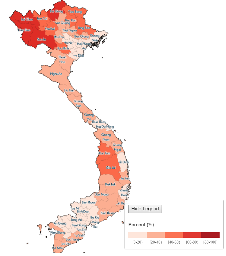
We just launched the new MapVietnam website at www.worldbank.org/mapvietnam/ which provides access to socioeconomic data at the province and district level in both English and Vietnamese. The site is intended to be a resource for journalists, policymakers, researchers, and citizens looking for information on social and economic situations at a local level. The maps illustrate Vietnam’s wide diversity, which can be lost in aggregate statistics. It is available in both English and Vietnamese.
How do you use the site? Click on an indicator on the left then move your cursor over the map. Click once to pull up a summary table for a province. Double click to zoom in and click highlighted parts for districts. Data, including sources, can be downloaded for both provinces and districts. Find out more here.
Most of the information on the site is drawn from Vietnam’s 2009 National Population and Housing Census, which is the most recent source of data at the district level for most indicators. Other data sources—more recent household surveys and administrative sources—can only be used to calculate figures at the regionalor provincial level. The map also includes, at the provincial level, the most recent (2013) income-based poverty estimates from MOLISA (Ministry of Labour, Invalids and Social Affairs) as well as child stunting (malnutrition) rates.
Here are a few highlight observations from the map:
- Poverty, by any of the five measures available on the map, is highest in the Northern Mountains—particularly on the far north and northwest borders—and is also high in the Central Highlands region. Within those regions, however, there is substantial variation, with some districts having much lower poverty levels.
- The World Bank’s twin goals focus on eliminating extreme poverty and boosting the income of the poorest 40% of the population (defined nationally). The map shows that large fractions of the population in rural Vietnam fall in the bottom 40%. In most cities, particularly the larger metropolises of Hanoi, Ho Chi Minh City, Danang, and Haiphong, few people are in the bottom 40%. In the Tu Liem and Tay Ho districts in Hanoi where many foreigners (including myself) reside, just 1% is in the bottom 40. In contrast in the district of Da Krong in Quang Tri province (northern Central Vietnam) that I visited last week, 92% are in the bottom 40.
- Everywhere, Vietnam has astounding levels of electricity connectivity, measured by the fraction reporting that they use electricity as their main form of lighting. This figure is over 90% in almost the entirely country, and over 70% even in the most remote districts in the north and northwest.
- In the interlinked areas of nutrition and sanitation access, Vietnam has made impressive progress but still has opportunities to improve. Access to flush toilets is high only in urban districts, and malnutrition (measured as the fraction of children under age 5 who are stunted) is surprisingly high across the country—in the range of 20-40% everywhere except the largest cities.
I invite you to explore the map and share your insights on the patterns it reveals.


